Special Update for Special Rains in South Tamil Nadu
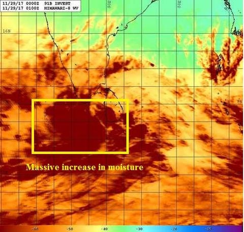
Heavy Rainfall warning from tonight and 30th November till Dec 1st as the Low Pressure near Sri Lanka will intensify into rare Cyclone in next 1-2 days in Comorin.
Laskhwadeep sea
======================
Please refer IMD for official warnings. This post is put on self interpretation. Do see all the images put up. Well Well, as everyone talk revolves around what is going happen on December 4-6th in Chennai, silently the present low in Sri Lanka is going to move into Comorin Sea near Kanyakumari on 29th Night and 30th.
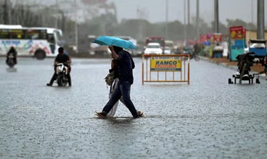
Heavy to very heavy rains possible from today evening and particularly on 30th November
-----------------------------
The rains will start mostly tonight and tomorrow is the day to be in extreme vigil. Kanyakumari, Nellai, Theni and Thoothukudi in particular. Not only these districts, the near by Virudhunagar, Ramanathpuram, Delta belt of Thiruvarur, Nagapattinam, Thanjavur, Trichy, Dindigul, Madurai, Sivaganga, Pudukottai, Cuddalore other interior district such as Namakkal, Trichy, coimbatore, tiruppur, Erode, salem, karur will also get rains for atleast a day. Nilgiris too will get rains particularly coonoor belt as the valley opens to east when the low pressure moves from comorin sea to Arabian sea, moisture gets trapped and gives heavy rains there.
But heavy rains to extreme rains possible in Ghat areas of Kanyakumari, Nellai and Theni districts particularly from tonight to 1st December.. Watchout for Kodayar-Pechiparai-kulasekhram belt in Kanyakumari and Papanasam - Manjolai belt in Nellai.
Overall, South TN and Interiors districts close to South TN are going to be flared up. After a long long time.
Fishermen
------------------
If you know any fishermen in these areas of Kanyakumari, Tirunellveli, Thoothukudi, Ramanathapuram, Gulf of Mannar, South Kerala coast. Please inform them not to venture into coast. This is all happening so fast.
Winds - Watchout for high winds and gusts.
-----------
Tricky one - winds of 60-70 km/hr are possible and gusts will be even higher on 30th November particularly in Kanyakumari, Nellai and parts of Thoothukudi district. Ramanathpuram district particularly in pamban and rameswaram could see high gusts.
It resembles to me like December 2010
===============
Last Time this area got good rains when low moved into this area gave very heavy rains to Kanyakumari belt around 2nd week of December 2010. In 2014 may too, heavy rains happened when a low moved into Comorin sea to Lakshwadeep sea. I could never forget both the instances i was right there in Kanyakumari in my hometown.
The epic was the Cyclone Phyaan in 2009. The low moved from SW bay like this one from Sri Lanka and moved into Comorin Sea and then into Arabian sea and then became cyclone. Who will forget the Ketti recording 820 mm in a day and coonor valley got landslides which is still the all time record for Tamil Nadu for a highest rainfall in a single day.
Next Cyclone
-------------
Next Cyclone moving in from Malay sea in Andaman. Things are turning positive for us for the next Cyclone. Shear is so low, it could intensify into cyclone very f fast. A special post on that later. Seems i am going to be very busy next week too. Lets first see this rains in south TN and then foucs on the other system later, we have so much time. Its too early to put an update on that.
Courtesy: Tamil Nadu Weatherman
Top Stories
-
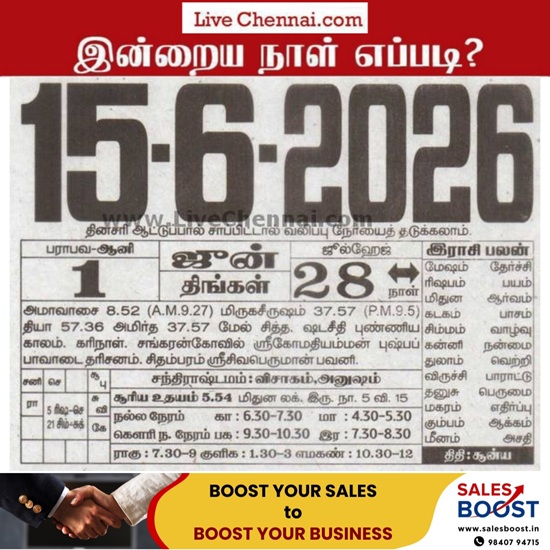 Auspicious Timings, Rahu Kalam and Panchangam for June 15, 2026 (Monday)13/Jun/2026 4:55:04 PM
 -
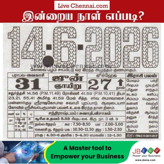 Tomorrow Panchangam June 14 2026 | Auspicious Timings, Rahu Kalam, Gulikai13/Jun/2026 4:54:08 PM
 -
 Power Shutdown Areas in Chennai - Sunday (14-06-2026)13/Jun/2026 4:26:01 PM
 -
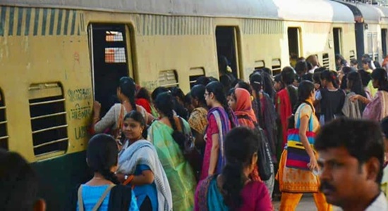 Top 10 Busiest Railway Stations in Tamil Nadu 2025-26 - Watch Full Video13/Jun/2026 4:09:58 PM
 -
 Paint Like Picasso: Unique Art Workshop in Chennai at Third Wave Coffee Kilpauk13/Jun/2026 4:05:11 PM
 -
 Heavy Rain Likely in Tirupathur, Vellore and Tiruvannamalai Today: Weather Department13/Jun/2026 3:57:09 PM