Orange Alert for Tamil Nadu as Two Weather Systems Intensify in Bay of Bengal
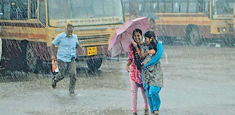
The India Meteorological Department (IMD) has issued an Orange Alert for extremely heavy rainfall in Tamil Nadu today, warning that a few districts may receive 120 mm to 200 mm of rain.
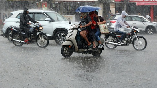
Due to a lower-level atmospheric circulation over the southeast Arabian Sea, the Chennai Meteorological Centre had earlier cautioned that 10 districts, including Tirunelveli, Ramanathapuram, and Thanjavur, are likely to receive heavy rainfall on Monday.
In the latest update, IMD has confirmed that Tamil Nadu, Puducherry, and Karaikal regions may experience very heavy rain at isolated locations today. Moderate rainfall is also expected to continue across Tamil Nadu and Puducherry for the next seven days.
Meanwhile, two developing weather systems are being closely monitored:
1. System over Malacca Strait & South Andaman Sea
A low-pressure area that formed on Saturday (Nov 22) over the Malacca Strait and adjoining South Andaman Sea intensified into a deep depression on Sunday morning (Nov 23).
It is likely to move west-northwest and intensify into a low-pressure area over the southeast Bay of Bengal and adjoining South Andaman Sea by Monday (Nov 24).
Within the next 48 hours, this system may strengthen further and develop into a cyclonic storm named ‘SENYAR’ over the southeast Bay of Bengal by Wednesday (Nov 26).
2. Circulation over Kanyakumari Sea
A new lower-level circulation formed on Sunday (Nov 23) over the Kanyakumari Sea and nearby regions.
Under its influence, a low-pressure area (cyclonic circulation) is expected to develop over the Kanyakumari Sea and adjoining southwest Bay of Bengal near Sri Lanka by Tuesday (Nov 25).
IMD continues to monitor both systems closely, as they may influence heavy rainfall over Tamil Nadu in the coming days.
Top Stories
-
 Tomorrow Panchangam August 01, 2026 | Auspicious Timings, Rahu Kalam, Gulikai31/Jul/2026 6:41:47 PM
 -

-
 The Businesses That Grow Consistently Have One Habit in Common31/Jul/2026 4:00:10 PM
 -
 Shankar IAS Academy Chennai: Courses, Fees, Facilities & Contact Details31/Jul/2026 3:58:41 PM
 -

-
 Tamil Nadu Heavy Rain Alert: 5 Districts Likely to Receive Heavy Rain Today and Tomorrow31/Jul/2026 3:22:02 PM