New Low pressure to be formed Today in the north and adjacent central Bay of Bengal!!
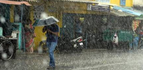
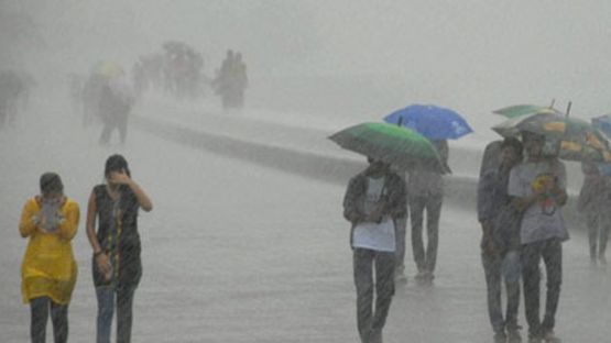
It has been raining in a few districts across Tamil Nadu now. Today, a new low pressure is expected to be formed over the north and adjacent central Bay of Bengal. As a result, there would be heavy rains in the hilly regions belonging to Coimbatore and Nilgris districts. Orange alert has been issued also.
In one or two places in TN, the temperature was 2 degrees Celsius above the normal. In the Thoothukudi district the temperature was 3 degrees to 5 degrees Celsius more than normal. In the districts like Karur, Madurai, Tirunelveli etc, the temperature has increased up to 3 degrees above the normal. In the districts belonging to Dharmapuri, Nilgris and Coimbatore, the temperature has decreased by 3 degrees Celsius. Yesterday, the temperature touched 100 degrees at Madurai and it was hot. In this scenario, the low pressure area that was present over the Bay of Bengal has settled over north Odisha and adjoining northwest Bay of Bengal and west Bay of Bengal. Today, this low pressure is expected to weaken.
It is learnt that due to the change in the speeds of westerly winds an atmospheric upper air circulation is present in the coastal areas of central Myanmar and adjacent west Bengal areas. Due to this a low pressure is expected to form in the north and adjacent central west Bay of Bengal today. It is expected to move westwards and strengthen as a low pressure area over northwest and adjacent central west Bay of Bengal tomorrow off the south Odisha north Andhra coasts. It would cross the south Odisa north Andhra coasts on 27th of September. There were rains in some places due to this reason. The sky would be cloudy in Chennai and there are chances of light rains across the city. The maximum temperature would be around 100 degrees.
Top Stories
-
 Power Shutdown Areas in Chennai - Monday (03-08-2026)02/Aug/2026 8:42:48 AM
 -
 Tomorrow Panchangam August 03, 2026 | Auspicious Timings, Rahu Kalam, Gulikai02/Aug/2026 8:36:32 AM
 -
 Tomorrow Panchangam August 02, 2026 | Auspicious Timings, Rahu Kalam, Gulikai01/Aug/2026 11:28:12 PM
 -
 This Friendship Day, Airtel Brings Back a Timeless Tradition - With a Modern Twist01/Aug/2026 6:58:33 PM
 -
-
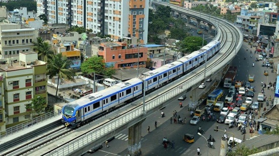 Chennai Metro Sets New Passenger Record: Over 10.63 Million Riders in July 202601/Aug/2026 6:38:30 PM