Heavy Rains Lash Tamil Nadu: Red Alert Issued for Several Districts (October 22, 2025)


Heavy rains continue to lash various parts of Tamil Nadu as the northeast monsoon has intensified across the state. As of 8:00 a.m. today, Vanur recorded the highest rainfall of 184 mm in the last 24 hours, according to official reports.
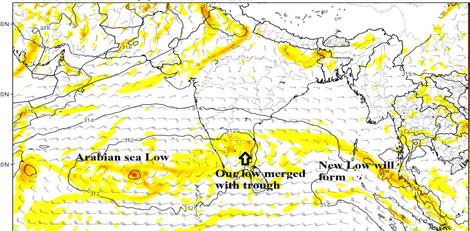
Meteorological officials confirmed that a low-pressure area formed over the southwest Bay of Bengal has now intensified into a deep depression. The system is expected to move towards the northern Tamil Nadu districts, Puducherry, and the southern Andhra Pradesh coast over the Bay of Bengal in the coming hours.
🔴 Red Alert
Districts under the Red Alert — where more than 20 cm of rainfall is expected — include:
Chengalpattu, Villupuram, Cuddalore, Mayiladuthurai, and Puducherry.
🟠 Orange Alert
Districts under the Orange Alert — likely to receive over 11 cm of rain — are:
Chennai, Tiruvallur, Kanchipuram, Ranipet, Tiruvannamalai, Kallakurichi, Ariyalur, Perambalur, Thanjavur, Thiruvarur, Nagapattinam, and Karaikal.
🟡 Yellow Alert
Districts under the Yellow Alert, where heavy rainfall is expected, include:
Salem, Trichy, Vellore, Tirupattur, Dharmapuri, and Pudukkottai.
🌧️ Maximum Rainfall Recorded (Last 24 Hours)
- Vanur – 184 mm
- Vallam – 170 mm
- Villupuram – 168 mm
- Uthukottai – 167 mm
- Thiyagadurugam – 125 mm
- Senji – 123 mm
- Walajabad / Avadi – 117 mm
- Kedar – 115 mm
- Thiruvalankadu – 112 mm
- Nekkunram – 110 mm
- Maduravayal / Valavanur – 106 mm
- Mandapam / Surapattu / Thindivanam – 103 mm
- Koliyanur – 100 mm
- Kalavai – 99 mm
- Madurantakam – 98 mm
- Saligramam / Aravakurichi – 96 mm
- Mundiyampakkam – 95 mm
- Marakanam – 94 mm
- Thirupuvanam – 93 mm
- Valasaravakkam – 91 mm
- Karaikudi – 90 mm
- Gummidipundi – 89 mm
- Sriperumbudur / Arcada / Needamangalam / Thirupattur – 88 mm
- Udumalai / Manalurpet / Sangarapuram – 85 mm
Officials have urged residents to remain cautious and avoid waterlogged areas. Disaster response teams and local administrations are on high alert in the affected regigions.