No. of views : (4286)
Cyclone Maarutha forms in Bay of Bengal, to intensify further
Posted on: 16/Apr/2017 3:11:34 PM

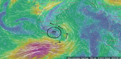
The deep depression in east-central Bay of Bengal has finally intensified into a tropical cyclonic storm on Saturday night. It is the first cyclone of the season to form in Indian Sea. Moving at a speed of 26 kmph, the cyclone is presently centered around 325 km west-northwest of Maya Bandar, Andaman and Nicobar Islands and 520 km south-southwest of Kyaukpyu, Myanmar.
According to Skymet Weather, Maarutha is very likely to gain more strength in the next few hours but its further intensification into a severe cyclone is not likely. With not much sea travel left and increasing vertical wind shear will hamper it from getting more marked. Besides this, another low pressure area is seen close to Philippine, which has been attracting most of the moisture available.
Maarutha will continue to track north-northeastwards and is most likely to cross Myanmar coast between Sittwe and Sandoway by the morning of April 17. At the time of landfall, the system is likely to give moderate to heavy rains over the coastal region of the country.
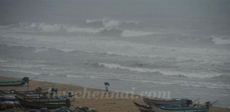
Squally winds of 60-70 kmph gusting up to 80 kmph will also be observed during that time. Sea conditions will also remain rough to very rough.
Though the system will spare the East Coast of India but northeastern states of Nagaland, Mizoram, Manipur and Tripura will record moderate showers with isolated heavy rains.
Courtesy: skymetweather.com
Post your requirement - We will connect with the right vendor or service provider