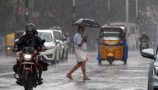
By the middle of November only, Chennai would get rains again

The news that has come out now is Chennai city would have to wait for a week of time till middle of November to get rains once again. It must be taken into account that the weather systems are gaining strength over the sea on either side of the peninsula.
The rains might be brought back to the coastal regions of TN including Chennai by remnants of the system brewing over Bay of Bengal. Point to be noted is system would weaken only by the middle of November and re-curve towards the southeast from Bengal and rains would be possible.
For the next 48 hours of time, the sky condition is likely to be partly cloudy with maximum and minimum temperatures likely to be around 33 degrees Celsius and 25 degrees Celsius respectively.
Meenambakkam in Chennai recorded 33.4 degrees Celsus and Nungambakkam recorded 33.6 degrees Celsius on Tuesday. Chennai had relative humidity peaking at 70 and 60 on Tuesday.
It is revealed by weather experts that clear skies and warm days could be due to areas of high pressure or anticyclone. Westerlies or dry land breeze could be due to the formation of weather system over Bay of Bengal and high humidity. It is important to mention that anticyclones pull air towards earth�s surface instead of rising up to cool and form clouds. This would lead to absence of cloud formation and there would be clear skies.
As per Mr. Pradeep John, weather blogger, it is clear that by middle of November Chennai would get rains. He added that the weather system would intensify to a cyclone over the Bay of Bengal and it would weaken and move down the east coast. Information is the cyclone when formed would be under the grips of upper level winds that are not easterlies.
It is revealed that the system might move towards Odisha. The system would get pushed down when it weakens and at that time low level winds which are easterlies take over. He concluded that weakened system might move towards south �Andhra, north-TN coast and the chances of this would be high.
It has been revealed by IMD that a depression that has moved westwards lies over east central and adjoining southeast Bay of Bengal and north Andaman Sea (about 200 kms west northwest of Andaman islands). During the next 12 hours, it is likely to intensify to a deep depression and further into a cyclonic storm in the subsequent 24 hours.
Top Stories
-
 CM Vijay Urges Youth to Choose Sports Over Drugs on International Day Against Drug Abuse26/Jun/2026 12:55:43 PM
 -
 Tamil Nadu Announces Chief Minister's Police Medals 2026 for Excellence in Anti-Drug Operations26/Jun/2026 10:57:56 AM
 -
 Tamil Nadu Weather Today: IMD Forecasts Rain with Thunderstorms in Chennai and 11 Districts26/Jun/2026 10:43:33 AM
 -
 Foods to Limit During Recovery for Better Health26/Jun/2026 10:26:19 AM
 -
 Southern Railway Cancels 49 Trains on Chennai–Arakkonam Route on June 27 & 28: Full List26/Jun/2026 10:18:30 AM
 -