
Tamil Nadu Weatherman Update: Cyclone Murasu May Intensify Near Andhra Coast – When Will Chennai Get Rain?
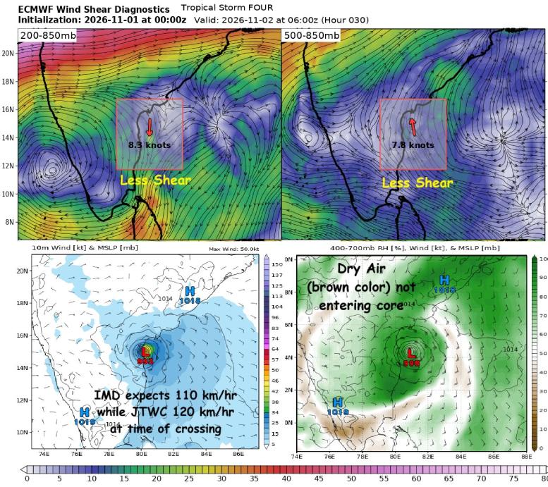
Cyclone Murasu is likely to cross the South Andhra Pradesh coast near Kavali as a Severe Cyclonic Storm, with favourable atmospheric and ocean conditions supporting further intensification.
According to the latest update shared by Tamil Nadu Weatherman, the system is currently experiencing favourable conditions that could help it maintain its strength until landfall.
Three Major Factors Supporting Cyclone Murasu
1. Low Wind Shear Favours Intensification
Strong vertical wind shear is one of the major enemies of a cyclone. It can tilt the storm`s vertical structure and displace upper-level clouds from its centre, weakening its circulation.
However, Murasu is currently experiencing very low vertical wind shear of less than 10 knots between 850 and 200 mb levels. This is highly favourable for cyclone organisation and intensification.
2. Dry Air Intrusion Could Affect the System
Dry air is another major threat to tropical cyclones. When dry air enters the storm`s core, it can suppress cloud formation and weaken the circulation.
In the case of Murasu, dry air is attempting to wrap around one side of the system. However, the cyclone is currently managing to protect its core.
3. Warm Sea Surface Temperatures Support Strengthening
Ocean temperatures also play an important role in cyclone development. Sea surface temperatures along Murasu`s expected path remain above 29°C.
These warm waters provide sufficient heat and moisture to support deep convection and further intensification.
Cyclone Murasu: Expected Wind Speed at Landfall
The overall atmospheric and oceanic conditions remain favourable for the cyclone to maintain its strength and potentially intensify further before crossing the coast.
According to the update, the India Meteorological Department (IMD) expects winds of around 110 kmph during landfall, while the US-based Joint Typhoon Warning Center (JTWC) estimates wind speeds of around 105 kmph.
Chennai Rain Forecast: When Will Rain Begin?
For Chennai and its surrounding KTCC (Chennai, Tiruvallur, Kancheepuram and Chengalpattu) regions, rainfall is expected to begin on Monday morning.
However, the intense rainfall zone is likely to remain over the sea, away from Chennai city.
North Chennai`s coastal areas may receive some good spells if rain bands move closer to the coastline. Areas in northern Tamil Nadu, particularly Ponneri, Gummidipoondi and Pulicat, may also receive heavy rainfall spells.
Overall Outlook
Cyclone Murasu continues to have favourable conditions for intensification, with low wind shear and warm ocean waters supporting its development. Chennai may experience rainfall from Monday morning, although the heaviest rainfall is expected to remain offshore.
Source: Tamil Nadu Weatherman
Top Stories
-
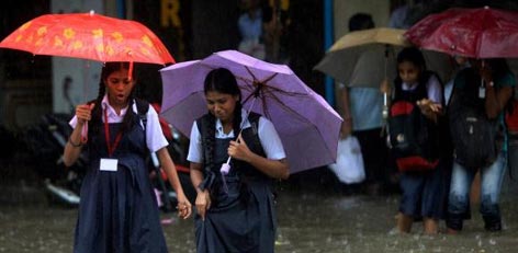 Chennai Schools to Remain Closed on November 2 Due to Heavy Rain Forecast01/Nov/2026 11:11:43 PM
-
-
-
 Chennai Metro Update: Poonamallee - Vadapalani Trains to Operate as Usual31/Oct/2026 5:38:16 PM
-
 November 2, 2026 Tamil Daily Calendar - Auspicious Timings, Rahu Kalam & Panchangam31/Oct/2026 5:33:57 PM
-
 Tomorrow Panchangam November 01, 2026 | Auspicious Timings, Rahu Kalam, Gulikai31/Oct/2026 5:30:45 PM

 JB Soft System