No. of views : (2836)
Warning for heavy rains, high winds given now in TN - Low pressure to intensify to depression
Posted on: 30/Nov/2020 9:15:40 AM
It is likely that the people belonging to TN and Puducherry would have to face the wrath of another cyclone soon!!
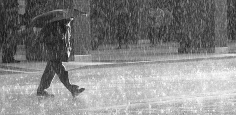
In the next 24 hours of time, the low pressure in the Bay of Bengal is expected to intensify further into a depression. This would lead to high winds, heavy rains and huge waves in the coastal regions.
As per TNSDMA or Tamil Nadu State Disaster Management Authority, southern parts of TN such as Tirunelveli, Thoothukudi, Kanniyakumari, Tenkasi, Ramanathapuram, Virudhunagar, Tiruvallur, Chengalpet etc are likely to get heavy rains on Tuesday and Wednesday.
According to Mr. N. Puviarasan, director, Area Cyclone Warning Centre, RMC, Chennai, the low pressure over south Andaman Sea and adjoining areas of southeast Bay of Bengal and Equatorial Indian Ocean has organised into a well marked low pressure area. He added that in the next 24 hours this low pressure is likely to concentrate into depression and intensify further. Around 2nd December, this would move west north-westwards and reach south TN coast.
On Tuesday, there would be heavy rainfall in places like Tirunelveli, Thoothukudi, Kanniyakumari etc and there would be thunderstorms in isolated areas in TN. The fishermen have been issued warning not to venture into the sea for fishing activities and those who have gone already into the sea must return back. In the southwest Bay of Bengal, Gulf of Mannar and in Comorin etc, winds speed between 50kmph to 60kmph gusting up to 70kmph would be there.
It must be noted that warning has been given to these areas and also to southwest Arabian Sea areas surrounding Maldives and Lakshadweep Islands etc. In the next 2days, Chennai would have partly cloudy skies and there would be isolated cases of light rains and the temperatures are predicted between 31 degrees Celsius and 23 degrees Celsius.