No. of views : (3777)
Chennai to go under the sea by the year 2100 confirms study
Posted on: 22/Apr/2019 10:01:05 AM
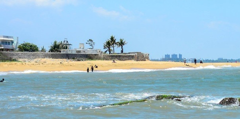
This news would surely be a bitter pill to swallow for the residents of Chennai and Tamil Nadu. The important information is by the year 2100 the stretch from the mouth of Adyar near Foreshore Estate to Thiruvanmiyur on the south Chennai coast could be under the seawater. The reason for that was because of the rising sea levels. This was according to a study published by some researchers belonging to the Anna University and National Water Centre, UAE University. From the existing shores, the sea water is expected to enter 40 metres into the land in the future.
By this both sea as well as groundwater would be mixed further and would affect the aquifer that is already under threat due to excessive extraction of water brought out by constant development of the neighbourhoods.
To identify the impact of the rising sea levels and the tidal effects on the complex aquifer, an area of 35 square km with Bay of Bengal in the east, Adyar River in the north, Buckingham canal to the west and Muttukadu backwater to the south were studied by the researchers. It must be taken into account that at 30 spots bore wells were dug for the study purpose. It is revealed that this portion is surrounded by the water bodies that are vulnerable to seawater intrusion and it had put the ground water aquifer under risk.
Three situations were studied by the researchers by simulating the data till 2100. The 3 situations were high tide and low tide with sea level rise on a six hour time interval, without considering tidal effect and sea level rise. The third one is with sea level rise of 2 mm per year till the year 2100.
Mr. L. Elango, department of Geology, Anna University or AU, spoke about how the estimated inundation due to sea level rise was 1.5 sq km having maximum surface coverage of 40 m in the northern part of the study area ( Adyar to Thiruvanmiyur). The important point is an inundation map is prepared with total sea level rise of 0.18 m by using Indian Remote Sensing Satellite (IRS) P6 images, Shuttle Radar Topographic Mission(SRTM) and Digital Elevation Model or DEM.
It is worthy to mention that the 100 year simulation of ground water table without considering the sea level rise shows a further reduction in the ground water table by a maximum of 0.35 m on the Adyar to Thiruvanmiyur stretch. Sea water intrusion might be possible due to this.