Tamil Nadu Weatherman: Deep Depression Near Chennai to Cross Kalpakkam Coast Tonight

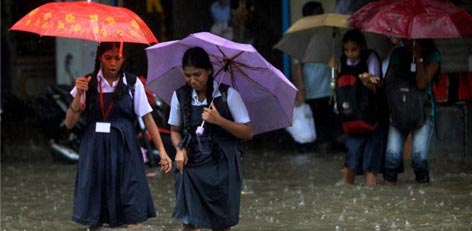
The weather system that was earlier known as Cyclone Ditwah has now weakened into a Deep Depression and has been lying close to the Chennai coast for the last 24 hours. The system has triggered continuous and intense rainfall over several parts of Chennai and Tiruvallur districts.
According to the Tamil Nadu Weatherman, the Deep Depression is expected to hover close to the coast for the next 18 hours, before making landfall south of Chennai near the Kalpakkam belt between evening and late night, in a weakened state.
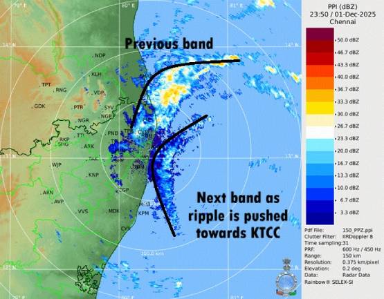
The system has not moved north beyond Chennai’s latitude so far. As long as it remains below this alignment, Chennai will continue to receive intermittent rain bands throughout the day, moving like ripples over the sea.
Rainfall Forecast
Moderate Rainfall
Regions likely to receive moderate rains include:
- Madurai, Virudhunagar, Sivagangai, Pudukkottai
- Delta districts
- Puducherry, Cuddalore, Villupuram
- Ranipet, Tiruvannamalai (especially after landfall)
Heavy Rainfall
-
Chengalpet and Kancheepuram districts have high chances of heavy rains today.
Very Heavy Rainfall
-
Chennai and Tiruvallur may receive very heavy rainfall later in the evening to night, due to strong convergence as the system crosses the coast.
Extreme Rainfall
- Nil
Advisory
Residents in low-lying and flood-prone areas are advised to remain cautious and follow official updates from the Meteorological Department and district authorities.
If you want:
- Tamil version
- Short bullet news for social media
- SEO keywords & hashtags
Just let me know!