No. of views : (4870)
Water stagnant areas in the city to get identified through mobile app
Posted on: 25/Oct/2014 10:18:07 AM

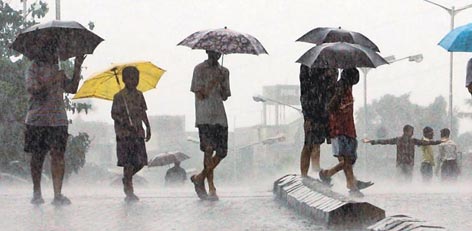
Chennai municipality is all set to go high-end with mobile applications. A new mobile application will soon be set up to identify water stagnant areas in the city. The required map is currently being devised.
Water stagnant areas are being precisely surveyed in an annual basis. In general, places that receive more number of complaints, places inspected by municipality workers, low-line areas, etc are identified and a map will be prepared. Now, the municipality is deriving plans to make use of satellite and a new software and identify water stagnant areas with utmost precision.
As a step, exclusive software by name Open Data Kit will be downloaded in all smartphones of engineers. When water stagnant area is captured in these phones, it will automatically store with it the exact geographic location of the area. These images will keep getting saved in the main computer used at the head office. Here, the images will get highlighted in red in places where water stagnation is identified.
In addition to the places captured by the engineers, areas that are complained of water stagnation will also be stored in the application. As of now, smartphones of 40 engineers carry this application and water stagnant areas are being identified. Engineers from about 200 wards will receive the application soon.
With this technically advanced method, the municipality will take necessary steps to revamp affected roads well before the commencement of monsoon rain, say officials. This application will not just be of help in identifying water stagnant areas, but also the belongings of municipality, and new roads that are to be laid across the city.